Tyneham Village Map
Tyneham Village is located on the beautiful Dorset coast, roughly between Lulworth and Corfe. The nearest populated towns include Kimmeridge and West Lulworth (not shown on this map).
All of the surrounding area and towns are truly wonderful with plenty of accommodation including guest houses, hotels, campsites and bed & breakfast.
Swanage, Corfe, Wareham and Lulworth are all very nice places to stay, to name but a few.
Tyneham Map
The map of Tyneham below shows the layout of the village and includes all the buildings that you can visit.
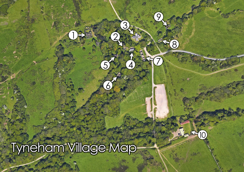
Key Buildings
- Tyneham Rectory
- Rectory Cottages
- St Mary's Church
- Tyneham School
- Laundry Cottages
- Gwyle Cottages
- Post Office Row
- Double Cottages
- Gardener's Cottage
- Tyneham Farm